Blog Archives
Mt. Baldy


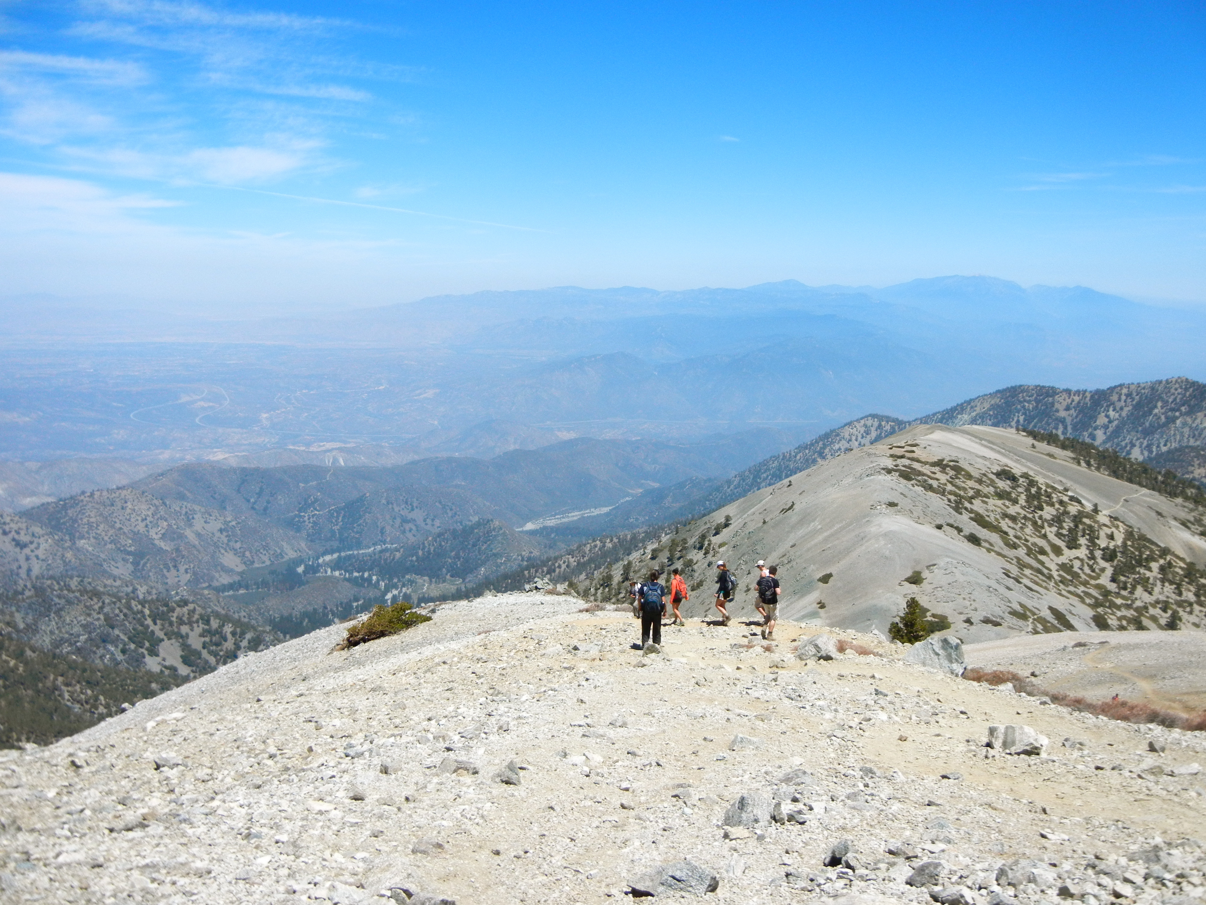


We ascended this 10,064 ft. peak via the Baldy Bowl Trail (otherwise known as the “Ski Hut Trail”), which starts at Manker Flats and, shortly after diverging from the San Antonio Falls Trail, begins to scale the side of the mountain. The rapid ascent means the king-of-the-world motivational factor sets in quickly, but it also means the strain in your glutes sets in quickly. You gain nearly 4000 feet of elevation in 4 miles. When we arrived at Manker Flats, we were like, “That was such a short drive. Why have we never been here before?” But by mile 3, we learned the answer to our question.
That being said, this was probably the most beautiful hike I’ve done in Southern California. You weave your way through Jeffrey Pine, scale your way through a Lodgepole forest, and get far-reaching views of the Antelope Valley, the San Gabriel Valley, and the San Gabriel range. And we weren’t even hiking on a clear day! I’ve heard rumor you can see all the way to the ocean if you plan your trip according to the skies.
Okay, so on our way down we took the Devil’s Backbone route to the ski lodge. There, we learned that an excellent option to experience the magic of Mt. Baldy might be to simply take the ski lift from Manker Flats to the Top of The Notch where you can sit on a dining patio with a burger and an IPA. But, as pleasant as that might be, you wouldn’t get to rise above tree line (the very root of why we call the peak “bald”) and you wouldn’t be able to say you’ve been to the highest point in Los Angeles County.

